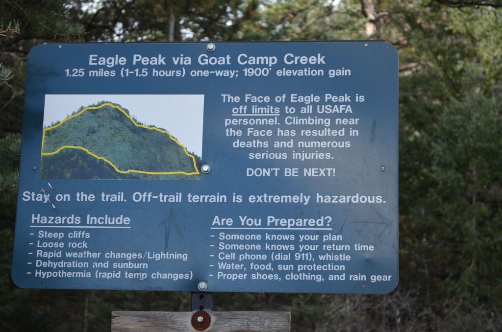
I’ll just leave this here. The yellow line on the sign is NOT a trail, it’s the area deemed “off limits” by the AF Academy superintendent. The north-facing rock walls at the top of the peak.
Even though it’s mid-November, we have had a nice spell of pleasant weather here, and I’ve been enjoying some hikes in the area. Over Veteran’s Day weekend I did two nice hikes along with another trip up the Manitou Incline.
One of the hikes was the most challenging I’ve experienced in over 15 years, back when Dave and I would tackle seemingly random mountains throughout the northern part of South Korea. I wish I could find more of the pictures of us on those mountains years ago…but I guess that’s for another project.
My friend Paige and I would chat on Facebook and come up with activities to do, both with and without our sons. She and I try to get together at least once a week…sometimes for lunch, but more often it’s for something more active. Last week we traded some trail websites around and I decreed that we should try Eagle Peak.
As the photo above indicates, it’s nearly 2000′ to the top…one blog suggests that if the Manitou Incline is possible for you, so is Eagle Peak.

There’s our goal. You won’t notice it unless you’re closer, but there’s a giant “04” emblazoned on the rock face. An overzealous senior rappelled down the rock face to put it there in 2004. Much of the paint has been covered up, but if you know the “04” is there, you can see it faintly.
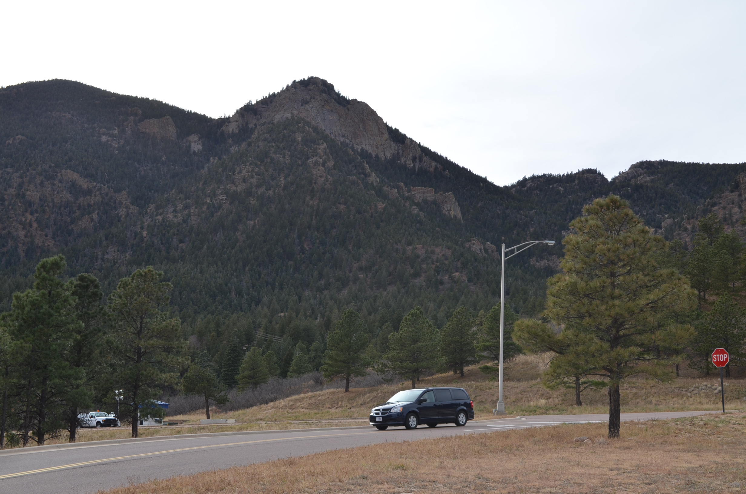
To get to the trailhead, it’s quite easy, and even the general public can take part. Simply head to the Air Force Academy and follow the signs to the Visitors Center. It’s open from about 8am-5pm daily (the hours may differ slightly on weekends). Park at the western side of the Visitor’s Center parking lot (there’s always space, except during Inprocessing week in June, when there are several hundred families dropping off their cadets).
From the western edge of the Visitor’s Center parking lot, head west across Academy Drive. There is a dirt road that continues westward from Academy Drive. Take that road until you see the large sign pictured at the top of this post. The trail begins behind that sign.
Here’s a map to help you.
I recommend only advanced hikers take this trail. I am NOT an advanced hiker, and it was really difficult for me. Paige and her husband joined me, and between the three of us, we were all commenting, “What were we thinking?” as we slipped and slid all over the trail.
While one of the blogs about this trail said, “If you can do the Manitou Incline, you can do this,” I’m not sure you can make the comparison. The elevation changes are the same, but at least on the Incline you have a straightforward set of stairs. This is way more challenging.
I don’t trust that my sons would do so well; I don’t think they could do this till they’re teenagers.
Several points of note about this trail:
1.) It’s not well marked. For the most part you’re simply following the most-traveled ground. We could make out footprints and simply followed that route. When you get closer to the top, keep your eyes out for spray painted dots and arrows on the trees and rocks. They aren’t easy to see. There were a few pink ribbons tied to trees as well. We missed a turn somewhere and summited in the wrong spot. We had to navigate up a little bit to get to the “real” peak.
2.) You’re on the NORTH FACE of a mountain. So even if you aren’t seeing snow down at the more-populated parts of the Academy, you will likely see snow/ice during the colder months. Even though it was in the 60s where we parked our cars, we encountered snow and ice on the trail, including about 100′ of “black ice” where the ground looked just wet, but it was actually frozen. Dress accordingly and be prepared to walk carefully on ice.
3.) You follow Goat Camp Creek for about 2/3 of the trail. We saw some beautiful ice formations in the creek, and you will have to cross the creek at some point. We saw several crossing points and they didn’t seem too bad.
4.) Going up may seem tough, but coming down was much much worse to me. We all took numerous spills down the soft talus.
Enjoy some more pictures from the hike.
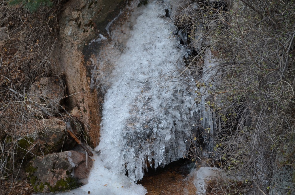
Along Goat Camp Creek, you can see many ice formations like this. It was in the 60s down at the parking area!

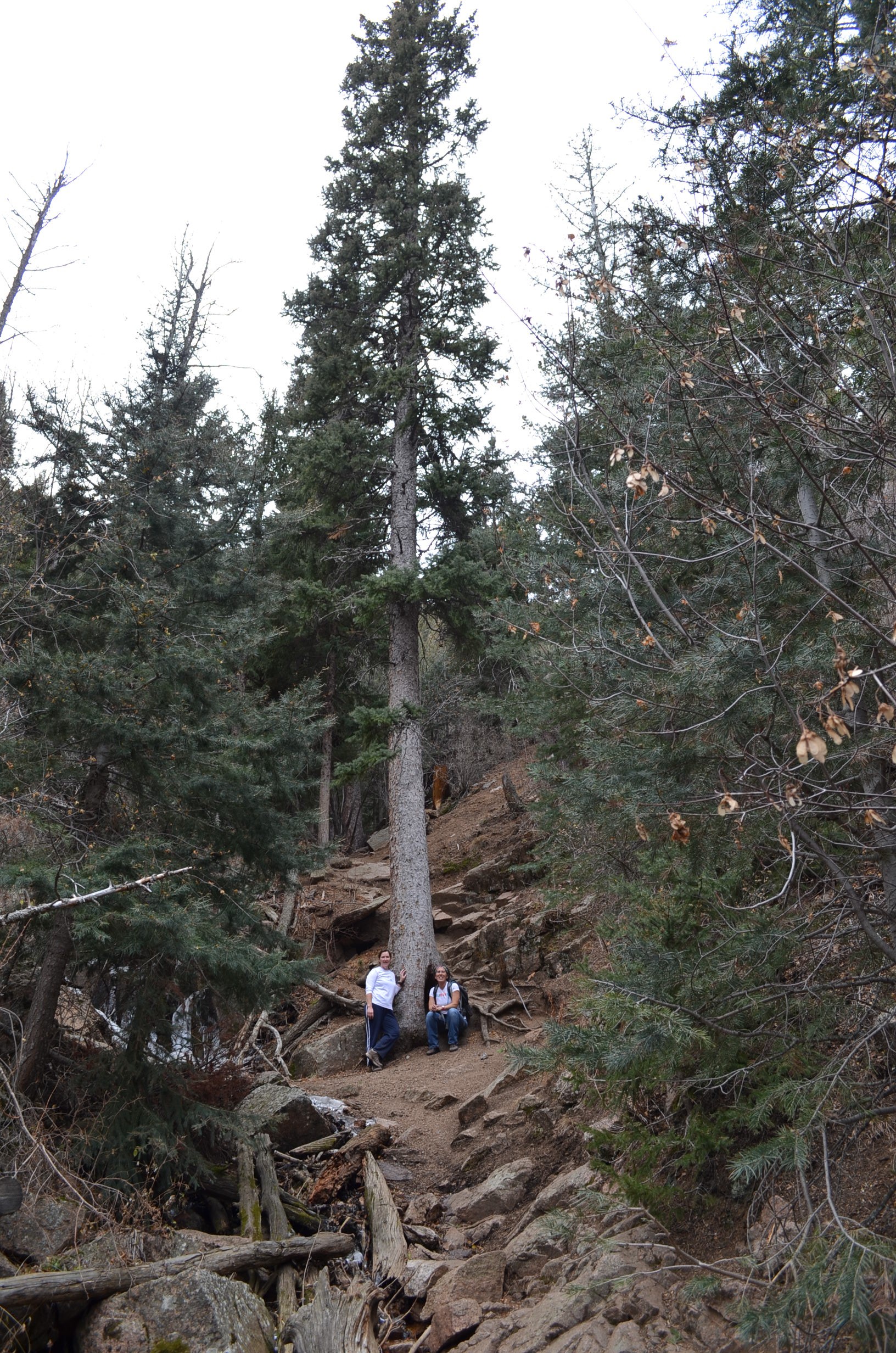
A cool tree!
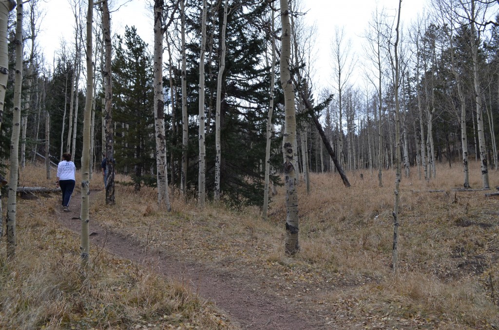
There’s a pretty aspen grove about halfway up. It’s a nice break from the crazy terrain.

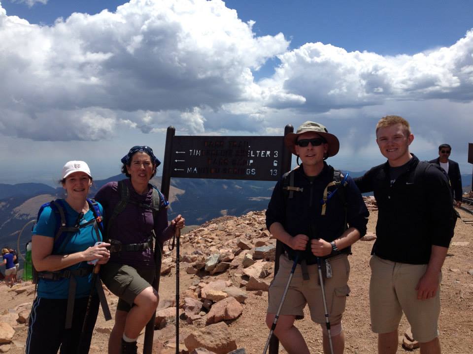
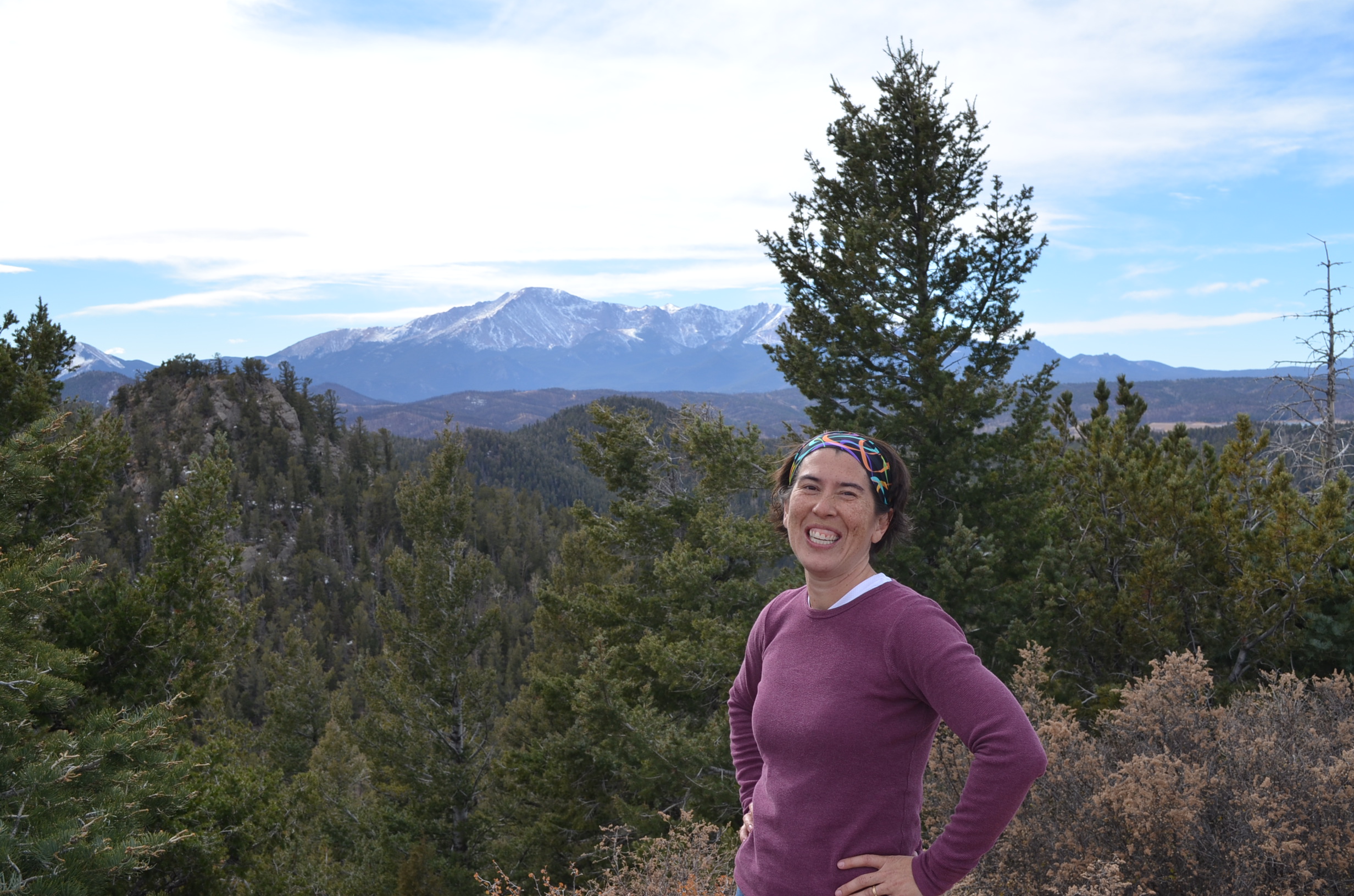
The view from the top makes the hard work worth it.
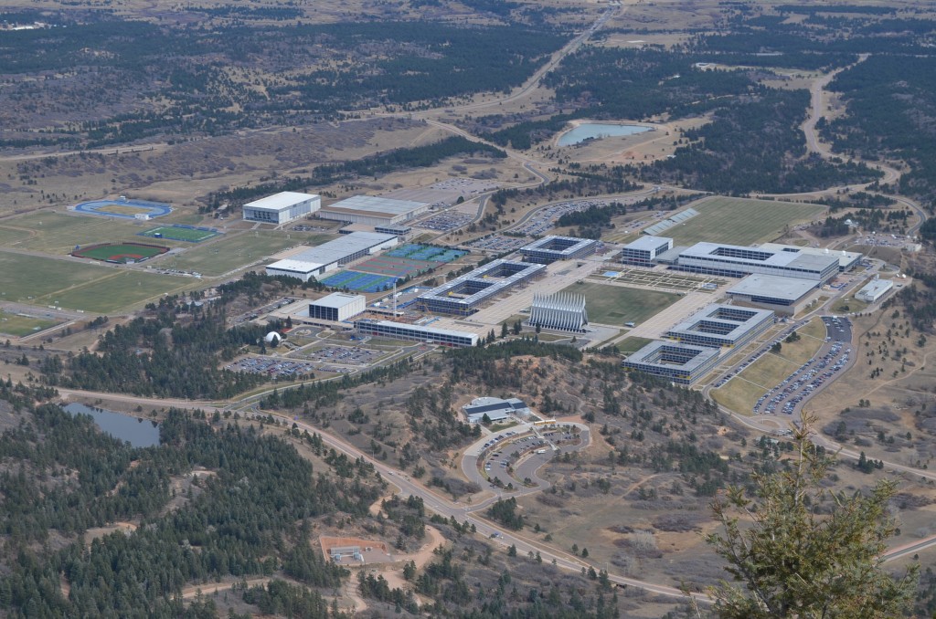
This hike is a popular “rite of passage” for AF Academy cadets. They all should see this view of their cadet area.
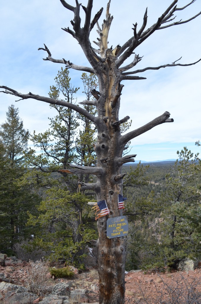
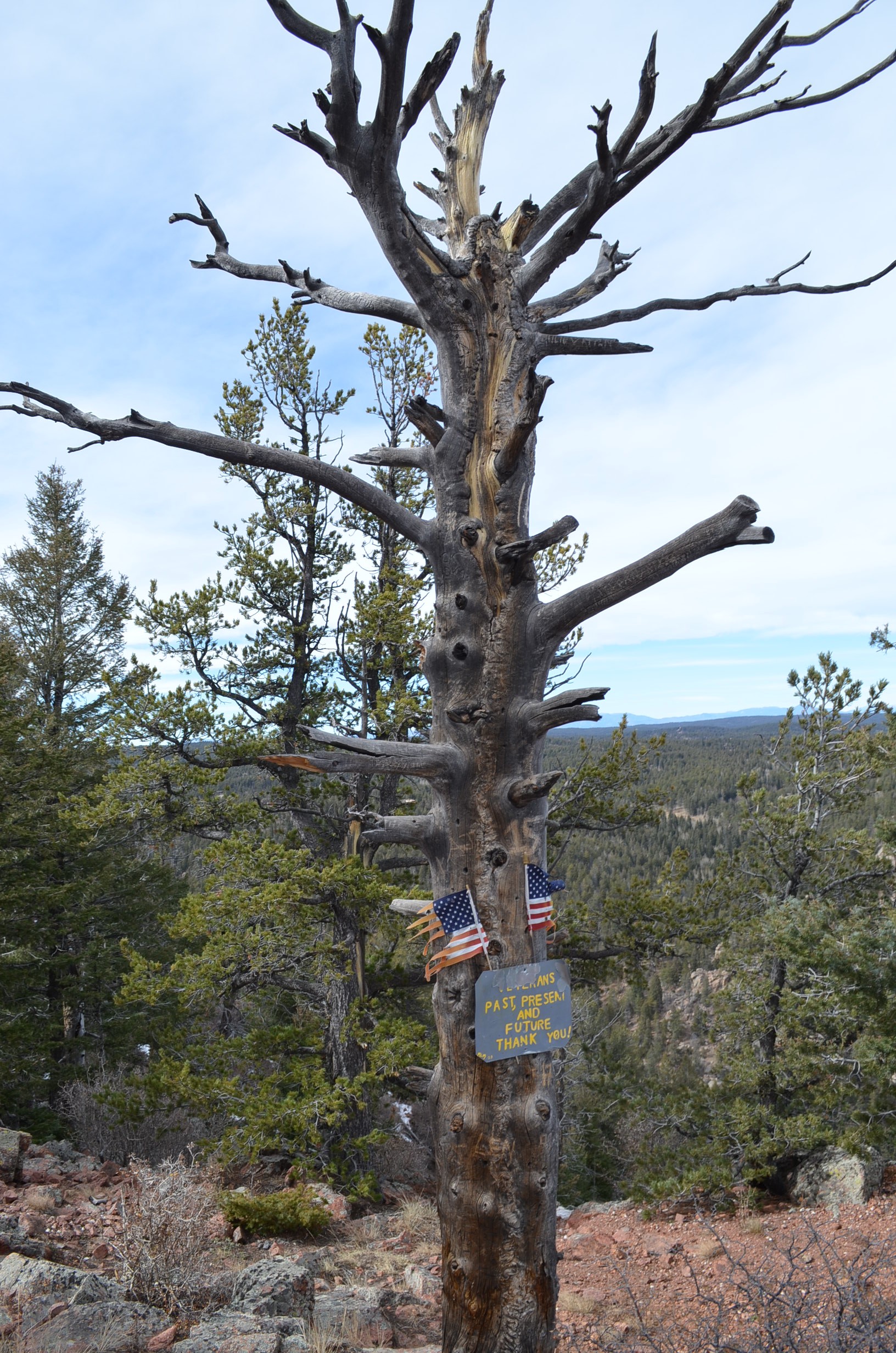
This tree was nice. Considering we did the hike over Veterans Day.


Recent Comments