
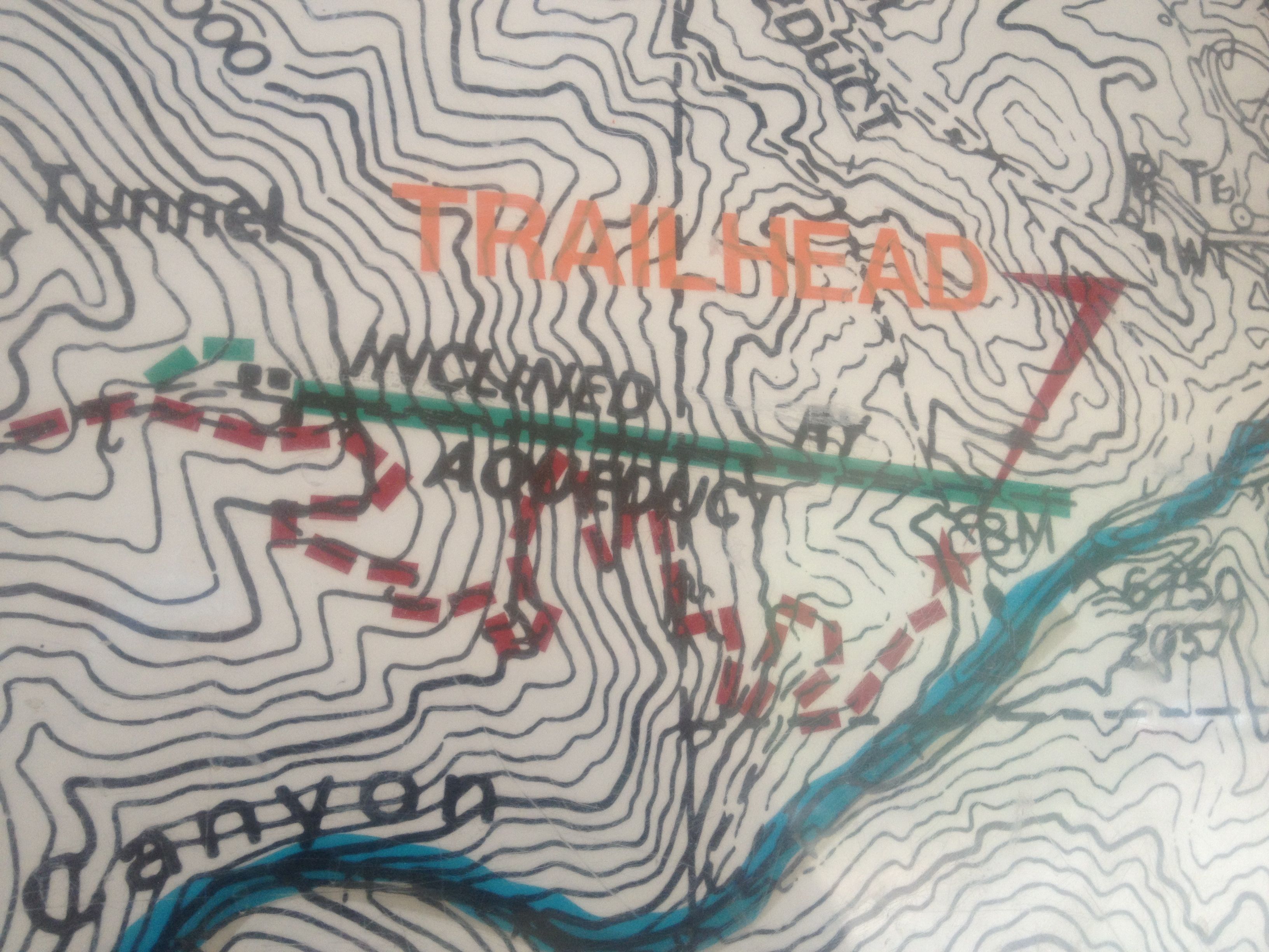
The Incline itself is the green line, and you ascend from right to left. Then you take the crooked red line down the mountain. One mile up, four miles back.
Locals in the Colorado Springs area frequent this very unique fitness challenge: The Manitou Springs Incline.
Manitou Springs is one of the towns due west of Colorado Springs. It’s known as a vacation spot for their natural springs and boasts the home of the Pike’s Peak Cog Railway (for another post).
It’s also the town with the trailhead for the hiking trail up Pike’s Peak, the Barr Trail.
Not far from the Barr Trail is something called “The Incline”.
“What on earth is this Incline you speak of?”
Well here’s a picture for you:
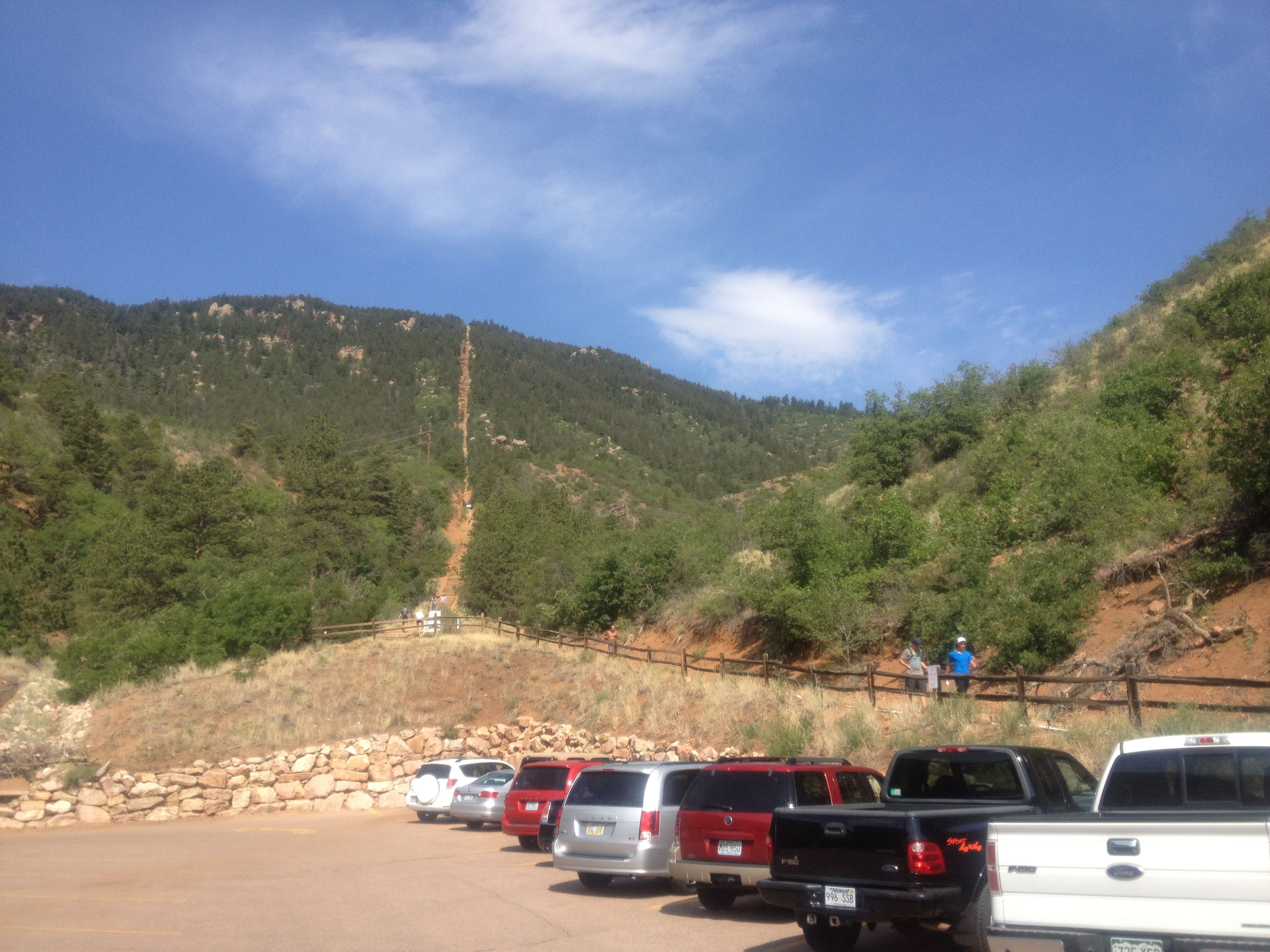
See that brown vertical gouge in the mountainside? That’s the remnants of an incline railroad that is now a popular fitness spot.
Dave and I decided to get away from unpacking the house over the July 4th weekend. We also decided to take advantage of having no kids around by doing something that might have been too tricky for the kids. We were skeptical trying to do this having only been in Colorado for 10 days, but decided we could bail at the “bailout point” on the trail 2/3 of the way up if need be.
A History of The Incline
The Manitou Incline as it exists today is the remnants of an incline railroad. The funicular was first built in 1907 and mainly served as an access to the water tanks and hydroelectric plant further up the mountain, both of which provided services to Manitou Springs and Colorado Springs.
In 1990, a section of track was washed out due to a mudslide, and the company — the Pike’s Peak Cog Railway — elected to not rebuild.
Since 1990, fitness fans have been conquering the incline. Unfortunately, until very recently, they had been trespassing. In addition, the increasing popularity of the fitness attraction began to cause a parking problem. While conservationists were hoping the incline would revegetate, in January 2013 the trail was declared “legal” as a public trail. A grassroots group known as “Incline Friends” was very influential in the decision, with fundraising efforts still ongoing to help maintain the trail. The Friends also plan to construct a more substantial trailhead center.
Getting to the Base of the Incline
As mentioned above, the immense popularity of the incline as a (relatively) short fitness excursion has caused more congestion at the end of Ruxton St. In the past, the cog railway and Barr Trail hikers had been the brunt of the vehicle traffic.
When Dave and I got to the end of Ruxton St., at about 9am on Friday, July 5th, the traffic was insane. We spent about 10 minutes attempting to find parking close to the trailhead, but instead had to go about 1/2 mile back down Ruxton St. towards downtown Manitou Springs to parallel park at one of the parking meters.
The meters are more advanced than the simple dime/quarter meters such as in downtown Colorado Springs. Remember your license plate number, and then go to one of the kiosks nearby. There’s a kiosk about every 5-6 vehicle spots. Input your license plate number and select how many hours you want to park. If you use a credit card and offer a cell phone number…you can receive a text message when you have a little bit of time can text back additional time on the credit card!
We paid $5 for 4 hours of parking.
Dave and I had to walk 1/2 a mile uphill to the base of the incline. Well heck, we were exhausted by the time we even got there!
If you want an easier way to the base, check out the town of Manitou Springs’ new free shuttle bus service. Park at one of the lots near downtown and take a shuttle to a point less than 1000′ from the trailhead. Some of the parking is even free! When Dave and I learned of this, we wondered if we could take advantage of this for a very early start to a Pike’s Peak ascent (where they recommend you start right at sunrise), and it was nice to see that the shuttle service operates 24 hours per day through September 7th.
Fortunately, there are several porta-potties at the base…all the more to prepare for this excursion.
Our Experience, Or, “Why Didn’t We Wait To Do This?”
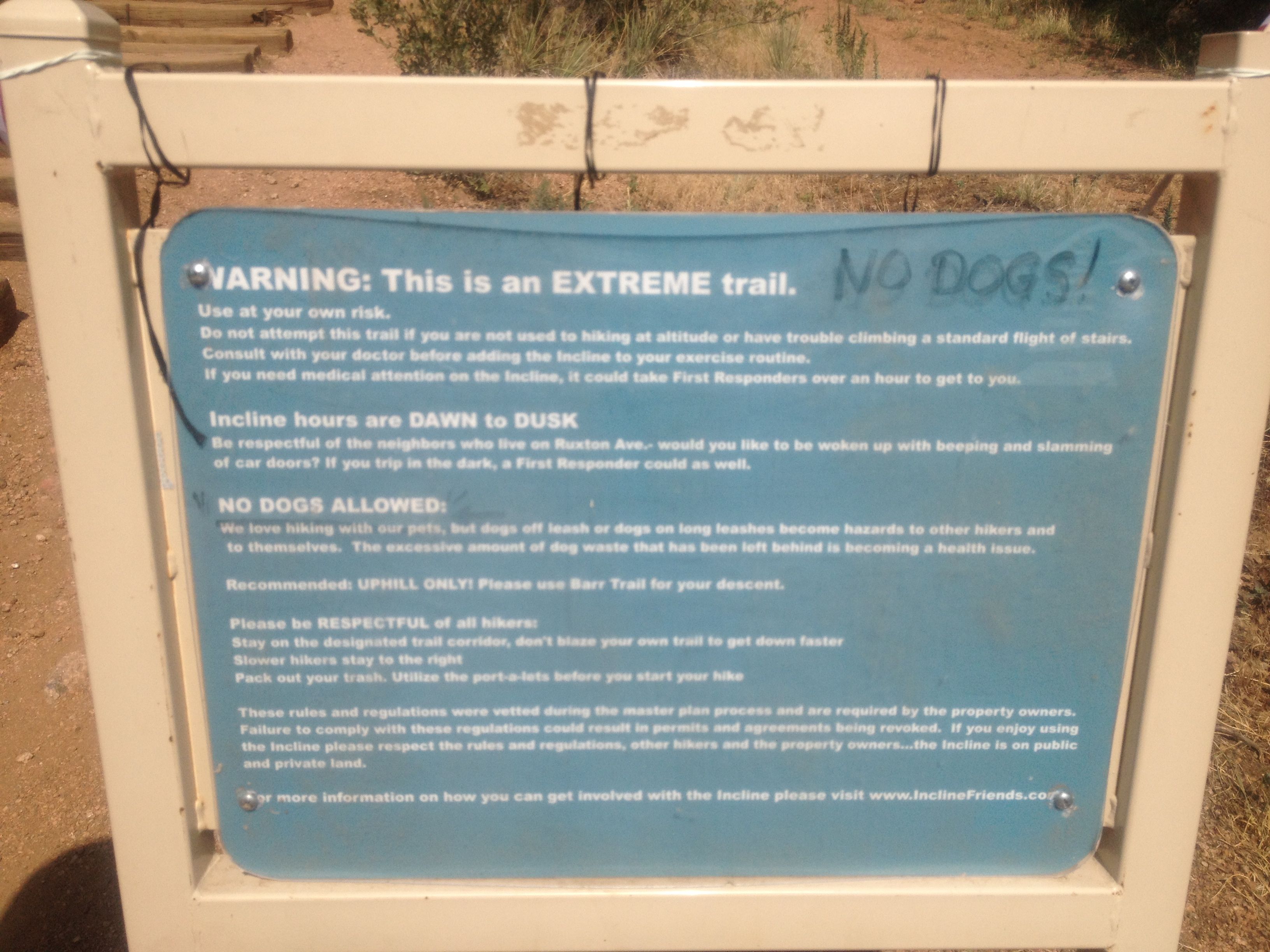
A look at the rules/guidelines for the incline. Click through to see a bigger picture and clearer text.
For the locals, it’s tradition to time your trip up the incline. Over time, you want to improve.
Before we headed up, I had Googled “Manitou Springs Incline Time” to see if there was a gauge of how long we should allow. This website suggested that routine incliners take between 30-60 minutes, but newcomers will take over an hour.
Apolo Ohno did the incline in under 18 minutes.
Dave and I played it safe by paying for four hours on the parking meter. We figured we’d be done with the round trip in 3 hours.
The incline starts with a more gentle slope at the bottom half, then becomes very steep. In fact, the steepest incline is 68%, with an average incline of 41%.
We clearly were ascending too fast at the bottom. We were not accustomed to the elevation quite yet, and every 200 steps or so, I had to stop. My lungs were searing! I told myself, “You are more fit than this, Patricia! Come on! It’s just a flight of stairs!”
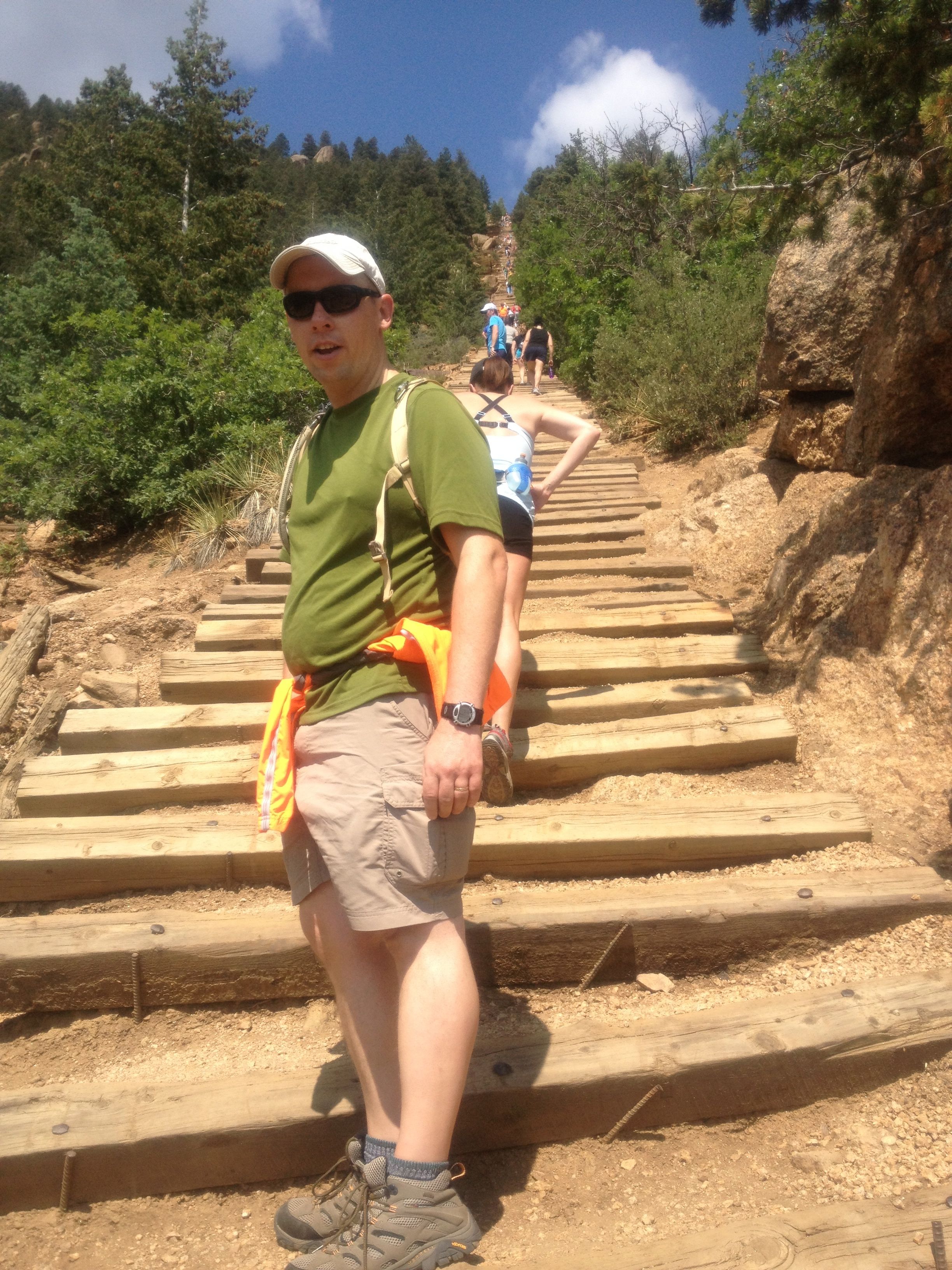
Here’s Dave waiting for me. This was a common sight during our ascent, Dave waiting. The woman in front of him was vacationing from Seattle and we were going about the same speed all the way up. You can see how crowded the incline is.
I had to slow down. I took a queue from other climbers and decided to come up with a methodical way to slow down.
I kicked every step before I took it.
I kicked each step before I took the step. It annoyed Dave, but it helped me slow down.
Dave thought it was annoying, but I will say that it helped me put more distance between breaks. And I thought to do this just before the trail became more steep. What a huge difference!
We saw all sorts of people ascending the incline: young (as young as Timmy!), older, walking, running. We saw a man running DOWN in the incline (while not “illegal”, it’s considered rude). We met many military families…it’s easy to tell with the haircuts and camouflaged Camelbaks.
At every break, Dave and I admired the view.
About 2/3 of the way up, there’s a part of the descending trail that butts up against the incline. This is a spot where you can “bail out”. Boy was it tempting, but we persisted.
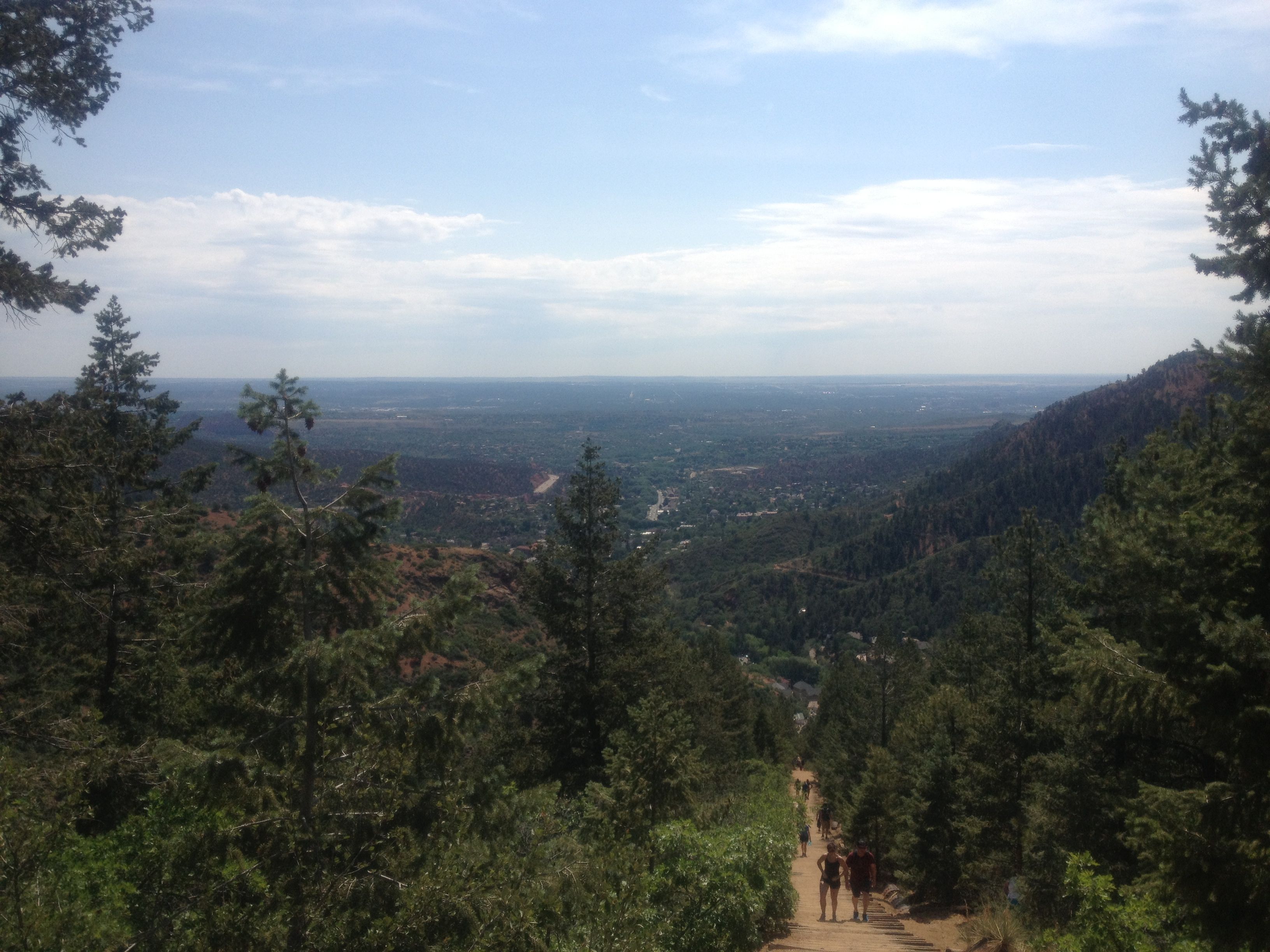
Breathtaking!
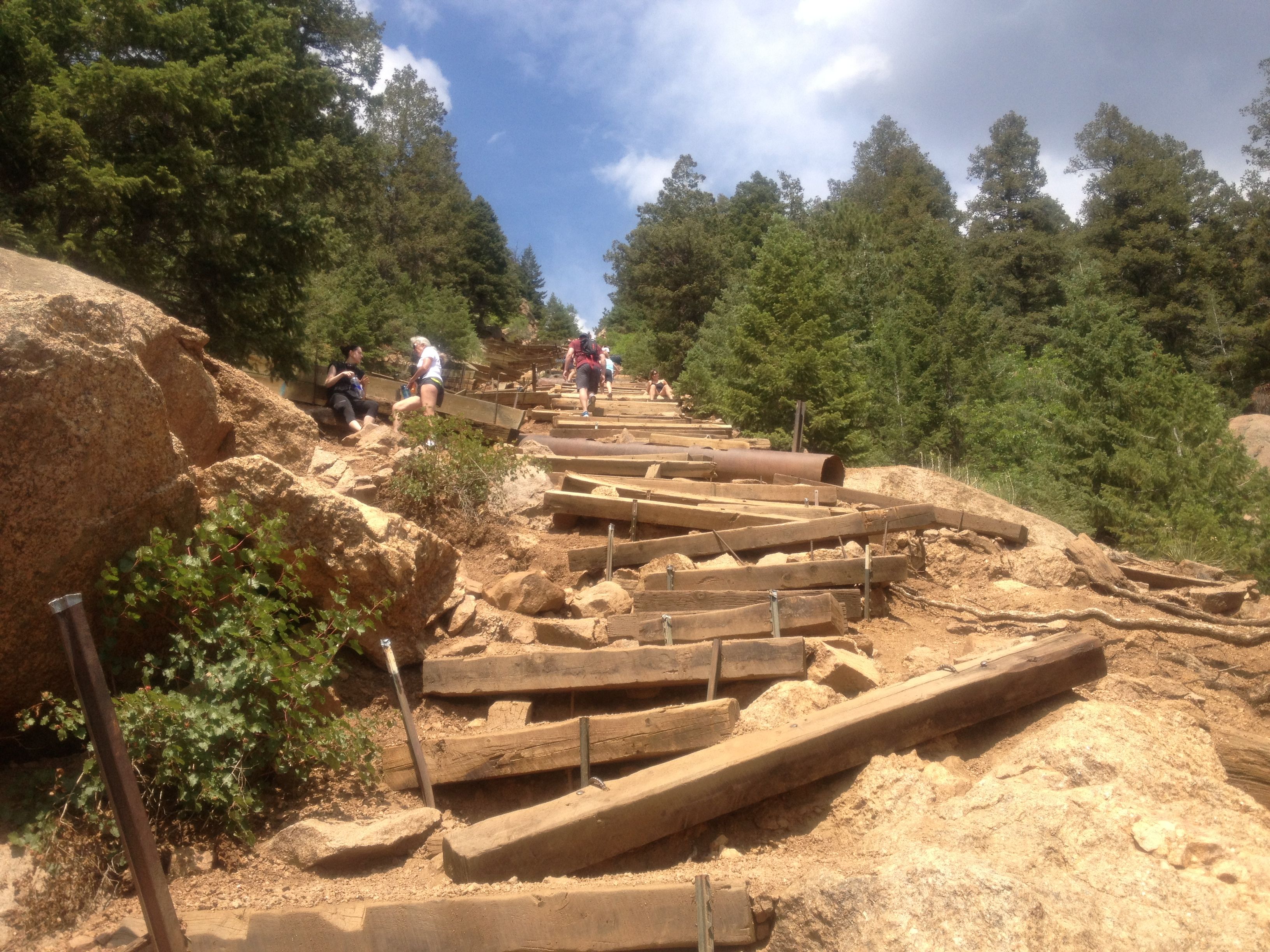
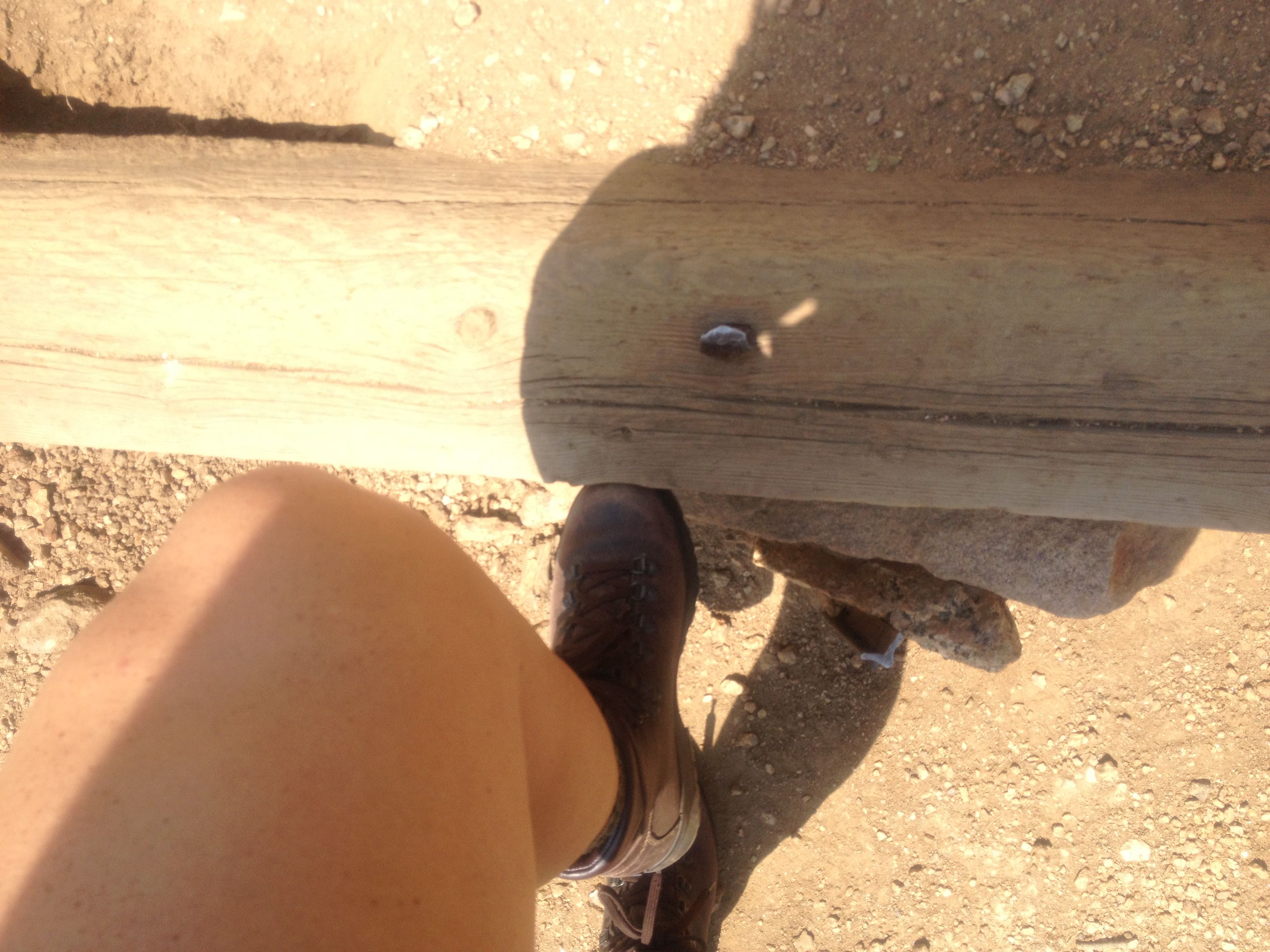
The terrain gets pretty tricky in spots. This is an advanced trail…not recommended for inexperienced hikers.
There is a “false summit”. When you’re at the base staring up the mountain, you can only see the first 3/4 of the incline. Be prepared for another 400 meters after that summit.
2000′ feet, 2700+ steps and about 95 minutes later, we made it to the “real” summit. It’s a great feeling knowing we made it!
We spent about 20 minutes at the top admiring the view and admiring our hard work 🙂

The Incline Conquered! Note there’s a kid behind us. Yes, experienced kids could do this.
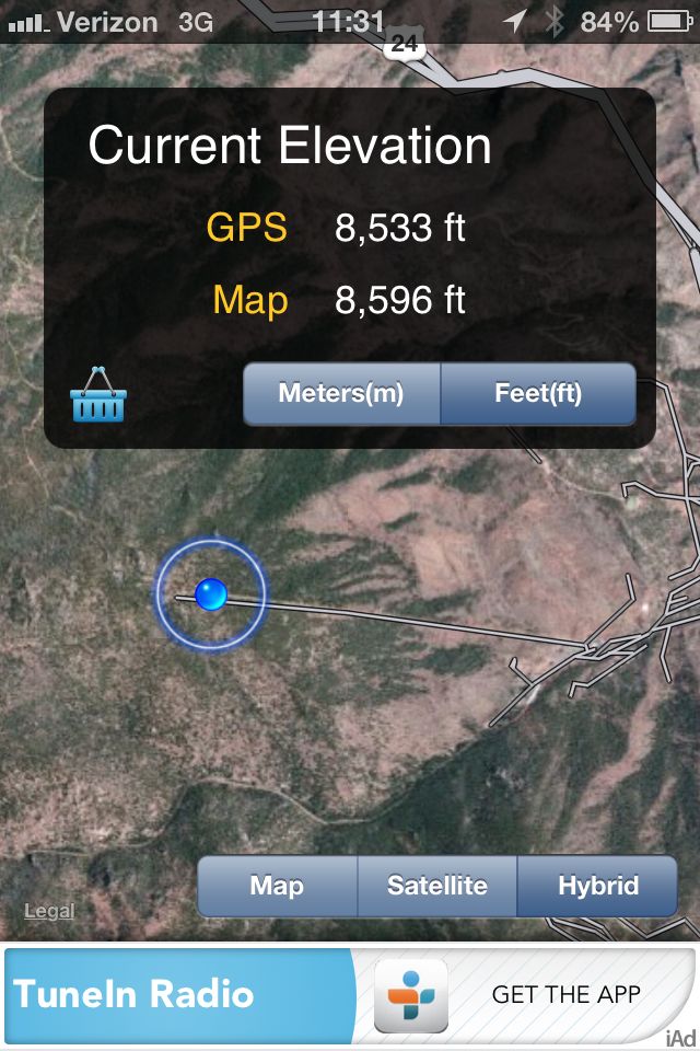
My “Elevation” app was useful to show how high we really were. This was at the top of the Incline.
The Descent
As I mentioned before, the polite thing to do is to ascend the incline, but descend on the Barr Trail, which picks up at the incline’s summit.
Simply bear left (south) at the summit of the incline and you can’t miss the Barr Trail…it’s probably full of the other incliners heading down.
Know that even though it’s only 1 mile up, the Barr Trail will be 4 miles down. And your legs won’t be happy the first time…but at least your lungs will calm down some.
It took Dave and me about 90 minutes to descend, but that was with several breaks to admire the views and have a snack. We saw many runners and we figured we could make it down in closer to an hour that way.
Conclusions
Dave and I logged a 90 minute Incline in July 5, 2013. I think we can do better.
We paid for 4 hours of parking meter, but we only needed 3 1/2 hours.
We most certainly plan to do this again.
Recent Comments